- Category: Space Y News
- 2021-10-12
- Leuven, Belgium
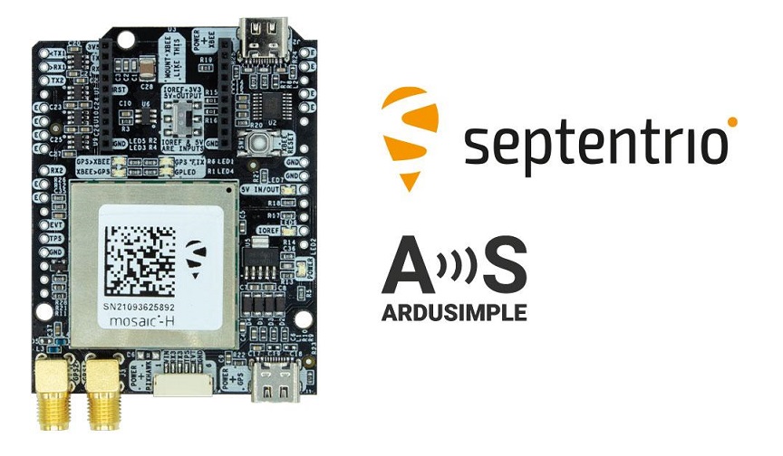
Septentrio, a leader in high-precision GNSS* positioning solutions, has announced that its compact GNSS modules mosaic-X5 and heading module mosaic-H are being integrated evaluation kits developed by ArduSimple.
With these new kits ArduSimple brings to market triple-band RTK as a plug-and-play solution for the most popular development platforms like Arduino, STM Nucleo, Raspberry Pi, Ardupilot and Nvidia Jetson. ArduSimple enables applications of the future, including robotics, UAV and autonomous systems, to easily try out mosaic, a unique module offering the latest high-performance GNSS positioning technology.
“The mosaic module complements ArduSimple RTK product portfolio with a higher-end solution for the most demanding applications. Triple-band GNSS brings extra reliability to the RTK solution and removes the headache of transitioning from L2 to L5 band. This combined with its feature-rich software, will allow our customers to accelerate even more their time-to-market” commented Marc Castillo, Senior Consultant at ArduSimple.
In addition to triple-band GNSS, mosaic module offers unmatched resilience to radio interference. This is especially important in robotic devices where electronic components, such as cameras and servos, are located close to the GPS/GNSS receiver, often interfering with weak GPS signals and causing positioning degradation. High-accuracy positioning is delivered at a uniquely high update-rate by mosaic-X5 in single antenna mode. Meanwhile, the board which mounts mosaic-H offers all-in functionality with dual-antenna mode for accurate GNSS heading.
The SimpleRTK3B board, which allows evaluation of the mosaic GNSS module, is now available for purchase via the ArduSimple web shop. For more information about mosaic or other Septentrio products visit septentrio.com.
* Global Navigation Satellite System including the American GPS, European Galileo, Russian GLONASS, Chinese BeiDou, Japan’s QZSS and India’s NavIC. These satellite constellations broadcast positioning information to receivers which use it to calculate their absolute position.
© Septentrio