Down to Earth
The Global GNSS Downstream Market
The global GNSS downstream market, i.e. the market of products and services that use GNSS-based positioning and navigation as a significant enabler, is one of the most promising markets in terms of growth. Globally, this market is expected to grow from around €260 billion in 2023 to around €580 billion in 2033 with a CAGR of over 8%.
Revenues from GNSS-based services, including both added-value services and augmentation services, are expected to account for €460 billion in 2033, representing 80% of the total Global GNSS downstream market revenues (Ref).
GNSS has already revolutionised a number of sectors, like transport and mobility, agriculture, and infrastructure monitoring. It has enabled for the creation of countless smartphone and tablet applications, and it has opened new market opportunities related to the use of drones, big data, connected devices and the Internet of Things (IoT).
As a result of the growing number of satellites, today companies are working on GNSS receivers with multi-constellation and multi-frequency features, ensuring higher accuracy. Moreover, receivers have increasingly compact designs and timing/synchronization features, also providing resilience to interferences. Finally, GNSS receivers are being embedded into innovative sensors that will continue enabling an increasing number of applications.
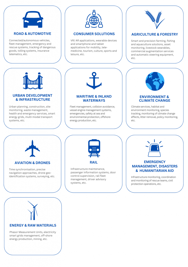
GNSS Market Sectors and Applications
Some key GNSS market sectors and applications include:
European GNSS Downstream Market
Galileo is Europe’s Global Navigation Satellite System (GNSS). It provides improved positioning and timing information that is useful to numerous European services and users.
The Galileo system, once fully operational, will offer six high-performance services worldwide:
- Open Service (OS)
- Open Service Navigation Message Authentication (OSNMA)
- High Accuracy Service (HAS)
- Public Regulated Service (PRS)
- Search and Rescue Service (SAR)
- Commercial Authentication Service (CAS)
- Emergency Warning Satellite Service (EWSS)
SBAS (Satellite-Based Augmentation Systems) are also an important component of GNSS-based services, augmenting the accuracy and reliability of GNSS signals. The European Geostationary Navigation Overlay Service (EGNOS) is Europe’s regional satellite-based augmentation system (SBAS) that is used to improve the performance of global navigation satellite systems (GNSSs), such as GPS and Galileo. It has been deployed to provide safety of life navigation services to aviation, maritime and land-based users over most of Europe.