EO Uses

EO Downstream Market

EO data serve diverse industries, foster the creation of new skilled jobs, and contribute to the growth of the European economy. Satellite remote sensing provides data and information that is useful to numerous national services and that can entail considerable savings for different users.

EO revenues for data and services is expected to grow from €3.4 billion in 2023 to almost €6 billion in 2033. EO services constitute the predominant market, with revenues estimated reaching €2.8 billion in 2023 and expected to grow to almost €5 billion by 2033, experiencing a CAGR of 6%. Revenues from EO data sales reached around €600 million in 2023 and are projected to experience a CAGR of 5%, leading to total revenues of €1 billion by 2033.

Almost half of the revenues are generated from the top three segments: Climate, Environment and Biodiversity; Agriculture; and Urban Development and Cultural Heritage. The Insurance and Finance segment is expected to emerge as the primary contributor to global EO revenues, reaching nearly €900 million by 2033. (Ref).

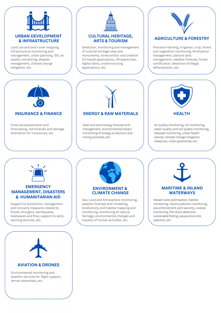
EO Market Sectors and Applications

EO supports a diverse array of applications across several non-space domains. Some key applications include:

Urban development and Infrastructure
Cultural heritage, Arts and Tourism
Agriculture and Forestry
e.g., land use and land cover mapping, monitoring of road and rail infrastructure, urban planning, GIS, urban greeneries mapping, air quality  monitoring, disaster management applications,  infrastructure management and maintenance, monitoring of soil subsidence, etc. e.g., detection, monitoring and management of cultural heritage sites and monuments, novel artistic and creative EO-based applications, crowd-sourcing applications, etc. e.g., precision-farming, irrigation management, crop monitoring, optimisation of fertilisation, vegetation cover monitoring, pastureland management, weather forecast, forest certification, detection of illegal deforestation, forest vegetation health monitoring, etc.
Insurance and Finance
Energy and Raw Materials
Health
e.g. financial assessments and forecasting, risk forecast and damage estimation for insurances, etc. e.g., solar and wind energy forecast and management, environmental impact monitoring of energy production and mining activities, etc. e.g., air quality monitoring, UV monitoring, water quality, soil quality, infrastructure maintenance, etc.
Emergency Management, Natural Disasters and Humanitarian Aid
Environmental protection and Climate change
Maritime and inland waterways
e.g. support to prevention, management and recovery measures related to floods, droughts, earthquakes, heatwaves and fires, support to early-warning services, etc. e.g. land cover and land use monitoring, weather forecast and modeling, biodiversity and habitat mapping and monitoring, monitoring of natural heritage and of environmental changes, monitoring of environmental impacts of infrastructure works, etc. e.g., vessel route optimisation, habitat monitoring, marine pollution monitoring, law enforcement, port security, coastal monitoring, fish stock detection, sustainable fishing, aquaculture site selection, etc.
Aviation and Drones
e.g., environmental monitoring and weather services for flight support, terrain awareness, etc.


EU Earth Observation

Copernicus is the Earth observation component of the European Union’s Space programme, focusing on our planet and its environment to benefit all European citizens. It provides information services that leverage satellite Earth Observation and in-situ (non-space) data.

The Copernicus system currently offers six services worldwide: